Bore Logger

From The Field To The Office
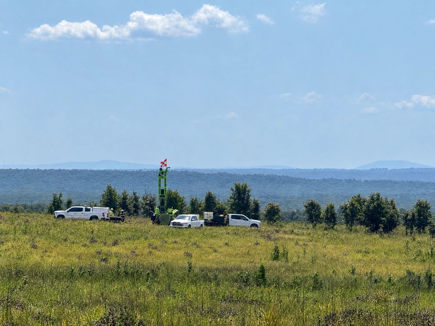
Bore Logger is a mobile app built for geotechnical field crews to log borings, samples, and site data directly from a phone — no clipboard, no paperwork, no re-entering data back at the office. It's built around the way fieldwork actually happens across geotechnical bore logging, environmental bore logging, well installation, and pavement coring — with support for SPT, Shelby tube, California, Sonic, Rock Core, and water table samples, each capturing exactly the fields it needs (blow counts, recovery, RQD, penetrometer and torvane readings) without cluttering the form with fields that don't apply. Environmental samples are logged right alongside standard geotechnical ones without leaving the boring you're working on, and every boring exports as a clean, professional PDF log — complete with your company branding and attached field photos — ready to share before you've even left the site.
From Boring To Report

1: Set Up Your Project
1: Set Up Your Project
1: Set Up Your Project
Every job starts here. See all your active and completed projects at a glance, with job numbers and client names right up front — tap into any project to get straight to its borings.

2: Track Your Borings
1: Set Up Your Project
1: Set Up Your Project
Every boring drilled on a project, listed in one place. See boring names and key details at a glance, with completed borings clearly marked — tap into any boring to log samples and start building the report.

3: Select Sample Type
1: Set Up Your Project
3: Select Sample Type
Log every sample as you take it — SPT, Shelby, Rock Core, and more, each with exactly the fields that type needs. Environmental samples get their own section, so soil and water samples sit right alongside your standard geotechnical data without ever leaving the boring you're working on.

4: View Samples
1: Set Up Your Project
3: Select Sample Type
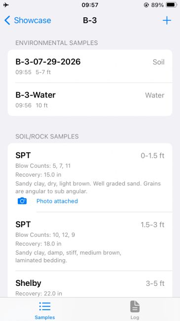
A running record of every sample taken in the boring, sorted by depth as you go. Blow counts, recovery, RQD, and descriptions show right on each entry, with a swipe to edit or delete — so the whole boring's sample history is visible at a glance, right where you're working.
5: Add Environmental Samples
5: Add Environmental Samples
5: Add Environmental Samples
Soil and water samples log right alongside your standard geotechnical data — no separate app, no leaving the boring you're working on. Select Environmental from the sample type list, choose Soil or Water, and capture the sample name, time, and depth in seconds.

6: Preview The Log
5: Add Environmental Samples
5: Add Environmental Samples
See your boring log take shape before you export — the same sections, same data, laid out and ready to become your final PDF. Review the project header, sample tables, and attached photos right on your phone, catch anything that needs a fix, and when it looks right, one tap generates a print-ready PDF you can share before you've even left the work site.

7: Share And Print
5: Add Environmental Samples
7: Share And Print
Once your log is ready, tap the share button to generate a PDF and send it straight from your phone — email it to a project manager, text it to a client, or save it to your files. No cables, no office computer, no waiting until you're back at the desk.

8: View the PDF
5: Add Environmental Samples
7: Share And Print
Each exported log is a clean, print-ready PDF — company branding, full project header, sample tables, and attached field photos, all formatted consistently no matter who on your team is logging the boring. Photos are automatically optimized to keep file sizes reasonable, so a report with several photos stays easy to email or share, even for a long boring.
Download Now!


Developer Notes
Version 1.0 — The First Release
This is where Bore Logger starts. Version 1.0 covers the core of what a geotechnical field crew actually needs on-site: logging borings and samples — SPT, Shelby tube, California, Sonic, Rock Core, and water table readings — each with the specific fields that sample type actually requires, without wading through fields that don't apply.
This version also introduces Environmental sampling built directly into the same workflow. Soil and water samples — including groundwater and equipment blanks — log right alongside standard geotechnical samples, without needing to leave the boring you're working on or switch to a separate app.
Every boring exports as a clean, professional PDF — complete with your company branding, a full project header, and attached field photos, automatically optimized to keep file sizes reasonable even on longer logs with several photos attached.
Version 1.0 also brings company-based licensing online, so field teams log in with their own company account, and firm data stays with that firm.
This is a first release, not a finished one. There's more on the way — including well installation and backfill data, and a move toward graphical boring logs — and this page will track it all as it ships.